


Sept. 6, 10:15 a.m. Gov. Roy Cooper says hundreds possibly trapped by flood waters on Ocracoke:

Gov. Roy Cooper this morning said flooding on Ocracoke Island is catastrophic and there are possibly hundreds trapped. State, local and federal officials are mobilizing to send help as Hurricane Dorian continues causing flash flooding across northeastern North Carolina.
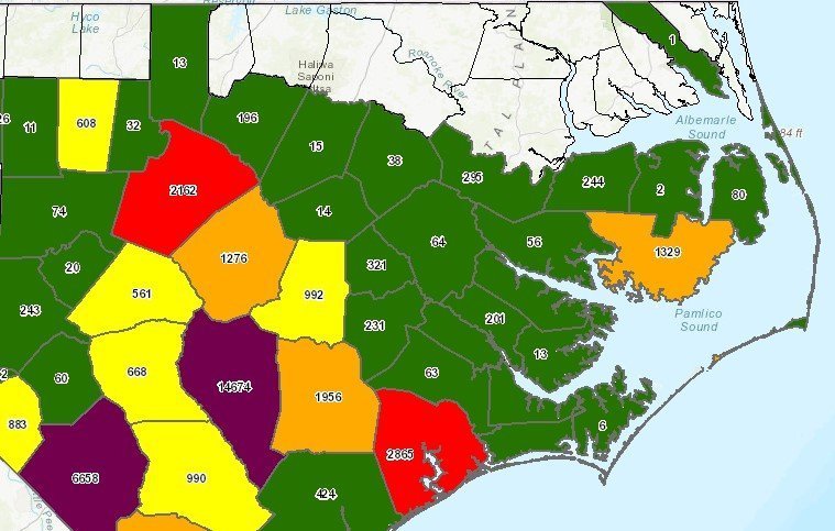
As of 10 a.m., more than 215,000 customers were without power in North Carolina, with all of Ocracoke, Hatteras and Carova beach in Currituck County in the dark.
Sept. 6, 9:20 a.m. Ocracoke inundated by soundside surge, Hatteras Island next
A flash flood warning is in effect until noon today for Ocraocke and Hatteras islands as Hurricane Dorian flooded Ocracoke, with water rapidly rising on Hatteras.
The National Weather Service says flooding will continue, with rapidly rising waters over Outer Banks’ sounds in the next few hours.
Water levels jumped 6 feet at Ocracoke in 90 minutes and 5 feet in 75 minutes at Hatteras village this morning.
Jason Wells video of the water starting to roar in from the sound in Ocracoke:
Water was pouring back into Hatteras Island:
Sept. 6, 8 a.m. Dorian nearing possible landfall on Hatteras Island
The National Hurricane Center reports the center of Hurricane Dorian was 10 miles west-southwest of Cape Hatteras, and a possible landfall could happen on Hatteras Island shortly.

And the water is starting to rise at Ocracoke and Hatteras:
Please RT: The WATER is beginning to RISE RAPIDLY over the eastern part of the Pamlico Sound. Graphic below is for Ocracoke but conditions will be similar in Hatteras soon! Be prepared to seek higher ground, immediately. #Dorian https://t.co/JneUE94Y7phttps://t.co/hMW8ecEcmR pic.twitter.com/fddmeKFECV
— NWS Newport/Morehead (@NWSMoreheadCity) September 6, 2019
Sept. 6, 6 a.m. Core of Dorian begins to skirt the Outer Banks
Conditions have been steadily deteriorating through the night, with heavy rain and steadily increasing winds.

From Jason Wells, owner of Jason’s Restaurant in Ocracoke:
As of 5:30 am the power is on and coffee is brewing. It’s very gusty and the house is shaking but so far no tide in my yard.
Just after that, he said the power started flickering briefly.
We have yet to see any soundside flooding reports, but there have been reports of standing water on some roads in the area from the heavy rains across inland areas.
Camden Sheriffs Office at 5:30 a.m.:
We’re beginning to see standing water on the roadways south of US 158. South 343 at Mill Town is submerged and impassable.
Pasquotank/Camden/Elizabeth City Emergency Management at 5:22 a.m.:
– Flora Street / Riverside Avenue
– Elizabeth Street @ Griffin Street
– Elizabeth Street @ Holly Street
– 1400 Block, Salem Church Road
– Southern Avenue (80%)
– Summerfield Street @ Oak Stump Road (subdivision is still accessible via Chesterfield Road)
– W Ehringhaus Street (near Sonic, Bojangles, Cookout)
– Hopkins @ Edgewood
– Church Street @ Griffin Street
– 90% of Pelican Point is impassible
– Greenleaf Street / Bell Street / Cypress Street
– Alleyway behind 512 E Main Street
– N Road Street at Alliance Nissan
– Griffin Swamp (traveling from Salem Church Road)
– Ward Street
Sept. 5, 10:30 p.m. Power outages increasing with the winds and rain
As bands from Hurricane Dorian move through the area, we are starting to see power outages increase across the area.
Tideland EMC has the most outages reported locally, with 1,329 customers in Hyde County already in the dark.
With weather conditions deteriorating rapidly, power companies will not be sending out crews to make repairs for safety reasons.
Power company outage reporting phone numbers:
Dominion: 866-DOM-HELP [866-366-4357]
Tideland EMC: 800-882-1001
Cape Hatteras Electric Co-op: 866-511-9862
Albemarle EMC: 800-637-1079
Sept. 5, 9:20 p.m. National Guard staging near Colington
The National Guard has a crew standing by at the Colington Volunteer Fire Department to assist firefighters in anticipation of flooding, which forecasters expect tomorrow on the soundside.

Sept. 5, 7:45 p.m. Time has passed to safely evacuate:
From Dare County Emergency Management:
The time to safely evacuate has passed and Emergency Management is advising those in Dare County to shelter in place until the storm passes. Conditions will deteriorate overnight and remain hazardous through Friday afternoon.
Curfews for all areas of Dare County, except for the Town of Kitty Hawk, will begin at 8:00 p.m. until noon on Friday. This curfew may be extended based on conditions.
Access to Dare County will be restricted at 8:00 p.m. with law enforcement stationed at checkpoints.
According to the National Weather Service:
Storm surge from ocean and soundside flooding is estimated at four to seven feet above the ground, not including wave action. Ocean flooding will increase tonight and continue through Friday night. Soundside flooding is forecasted to begin late Friday morning through Friday afternoon, as the storm passes and winds shift direction.
Winds are forecasted to reach 70 to 95 mph with gusts to 110 mph. Winds will increase overnight and are forecasted to reach hurricane force early Friday morning and remain in areas of the county through midday Friday.
Rainfall of 6 to 12 inches is forecasted through Friday afternoon with locally higher amounts possible.
Tornadoes are possible as Hurricane Dorian approaches, mainly this evening.
Monitor updated local weather forecasts, watches and warnings from the National Weather Service at www.weather.gov/mhx.
Visit www.darenc.com/hurricanedorian for updated information from Dare County, the towns of Duck, Southern Shores, Kitty Hawk, Kill Devil Hills, Nags Head and Manteo, and the National Park Service, Outer Banks Group.
Sept. 5, 6:30 p.m. Tornado watch expands:
The National Weather Service has issued a new tornado watch for eastern North Carolina and parts of eastern Virginia through 7 a.m. Friday.
The watch includes all coastal areas from the Cape Charles Light in Virginia to Ocracoke Island.
Dorian has produced several tornado warnings and at least one tornado, in Emerald Isle, so far today. The tornado left massive damage to the Salty Pirate Water Park of Emerald Isle and the adjacent RV park.

Sept. 5, 5:15 p.m. Hurricane Dorian 45 southeast of Myrtle Beach:
Hurricane Dorian was about 45 miles southeast of Myrtle Beach and 85 miles south southwest of Wilmington early this evening with sustained winds of 105 mph, making it a strong Category 2 hurricane.
Slow weakening is expected during the next few days, the National Hurricane Center reports. However, Dorian is expected to remain a powerful hurricane as the center moves near the coasts of South and North Carolina tonight and into tomorrow.
“Hurricane-force winds extend outward up to 60 miles (95 km) from the center and tropical-storm-force winds extend outward up to 220 miles (350 km). NOAA buoy 41004 to the southwest of the eye recently reported sustained winds of 60 mph (97 km/h) and a wind gust of 74
mph (118 km/h),” the hurricane center said in its 5 p.m. update.
Hurricane force winds are expected to move into North Carolina in the next few hours.
The combination of a dangerous storm surge and the tide will cause normally dry areas near the coast to be flooded by rising waters moving inland from the shoreline. The water could
reach the following heights above ground somewhere in the indicated areas if the peak surge occurs at the time of high tide.
Little River Inlet to Duck NC, including Pamlico and Albemarle sounds and the Neuse and Pamlico Rivers can expect to see 4 to 7 foot storm surge.
“Water levels could begin to rise well in advance of the arrival of strong winds. The surge will be accompanied by large and destructive waves. Surge-related flooding depends on the how close the center of Dorian comes to the coast, and can vary greatly over short distances,” the hurricane center said.
Six to 12 inches of rain is expected during the course of the storm and a tornado watch remains in effect for the Outer Banks until 7 p.m.
Sept. 5, 5 p.m. The water has already started rising in the Town of Belhaven:
Belhaven on the Pungo River took the brunt of the early storm surge flooding during Hurricane Florence last year, Hurricane Irene in 2011 and countless other storms. And the water is already up in downtown this afternoon.
Sept. 5, 4:30 p.m. Bay Drive residents prepare for the worst:
Bay Drive in Kill Devil Hills sustained severe damage in last year’s aftermath of Hurricane Michael. Residents today were preparing for the worst.
Bay Drive in Kill Devil Hills has seen more than its share of soundside flooding. Residents are prepped and ready for #Dorian #obx #ncwx pic.twitter.com/J7aRDIJkUF
— Sam Walker OBX Today??? (@SamWalkerOBX) September 5, 2019
Sept, 5, 3:30 p.m. Sandbridge evacuation ordered:
Virginia Beach has ordered a mandatory evacuation of the Sandbridge area beginning at 6 p.m. tonight. Voluntary evacuations are in order for all Virginia Beach residents in flood-prone zones.
Curfew for Dare County
Dare County has established a curfew as Hurricane Dorian bears down on the Outer Banks beginning at 8 p.m. tonight, Currituck County has brought in pumps to be ready to deal with flooding in Corolla, and parts of Camden and Pasquotank counties are now under mandatory evacuation orders.
Access into Dare County will end tonight, also at 8 p.m.
“The window of opportunity for evacuation is closing. Dare County Emergency Management strongly warns everyone to evacuate immediately to ensure the safety of you and your family,” Dare County said in a news release.
Curfew will continue through noon Friday, or longer if conditions warrant. The Town of Kitty Hawk is excluded from the curfew order.
North Carolina Emergency Management has opened shelters in other areas of the state, including pet-friendly locations. For updated shelter information, visit https://www.ncdps.gov/storm-shelters. There are no emergency shelters in Dare County.
Storm surge from ocean and soundside flooding is now estimated at four to seven feet above the ground, not including wave action. According to the National Weather Service, there will be periods of rapid water rise from the soundside as the storm passes, possibly into Friday evening.
Hurricane Dorian will bring life-threatening impacts to Dare County. Extreme ocean and soundside flooding, heavy rain and hurricane force winds are forecasted. Roads will become unsafe for travel and some areas will become inaccessible. Highway 12 on Hatteras Island is especially vulnerable to flooding and will likely become compromised and impassable.
Power outages are likely for an extended period of time.
To view storm surge estimates for your particular area, visit the National Hurricane Center’s storm inundation map http://bit.ly/StormSurgeOBX. Rainfall totals are estimated at eight to ten inches with up to 15 locally in some areas. In addition, winds are expected to reach hurricane force at the height of the storm.
Dare County remains under a Hurricane Warning and a Storm Surge Warning. A Flash Flood Watch is in effect through 8:00 p.m. Friday. A Tornado Watch is in effect through 7:00 p.m. Thursday. Monitor updated local weather forecasts, watches and warnings from the National Weather Service at www.weather.gov/mhx.
The ban on ocean swimming remains in place until further notice. Stay out of the water as it is unsafe for even the most experienced swimmers.
The next update from Dare County Emergency Management will be issued when necessary to provide critical, storm-related information. Visit www.darenc.com/hurricanedorian for updated information from Dare County, the towns of Kitty Hawk, Southern Shores, Kill Devil Hills, Nags Head and Manteo, and the National Park Service, Outer Banks Group.
Subscribe to receive emergency alerts via text, email or phone from Dare County Emergency Management at www.DareNC.com/alerts and follow @DareCountyEM on Twitter.
Currituck County
In anticipation of flooding from heavy rain and storm surge, pumps have been staged for use after the storm in Corolla and four-wheel drive areas.
Camden/Pasquotank/Elizabeth City
Effective immediately the following areas within Zone A are under a Mandatory Evacuation order:
Pasquotank County – areas south of the Elizabeth City Regional Airport
Camden County – Shiloh area and south.
Elizabeth City – Oxford Heights community
A Mandatory Evacuation Order means due to weather conditions there may be a point that emergency services may not be able to response.
Pasquotank, Camden and Elizabeth City Government Offices will be closed Friday.
This story originally appeared on OBXToday.com. Read More local stories here.